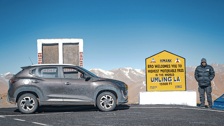
On the morning of 29th March 2022, we were the only two people anywhere in the world to be on a road this high. 19,300 feet above mean sea level to be precise. At a height that was 10% higher than Mt. Everest's Base Camp, our lungs struggled for each breath. Every single step was a herculean task and low oxygen levels led to our brains sending out the wrong signals across the nervous system. AMS or Acute Mountain Sickness set in, leading to levels of headache never experienced before. And the piercing cold fast winds froze every exposed part of the skin within seconds. Say hello to the world's highest motorable pass Umling la, a feat we achieved with one of India's most capable compact SUVs, the Nissan Magnite CVT.
So why this extreme adventure? While there are ample valid reasons, let me highlight a few. Umling la (la means a pass in local language) has recently been opened up for civilians and with the availability of proper tarmac at such altitude, it has been in the limelight for the right reasons. Second, Ladakh's season is starting off and we are assuming a lot of drivers (and riders) want to know more about this 'new' place. And third, Nissan recently rolled out the 50,000th Magnite from their manufacturing plant and this did call for a celebration at the roof of the world!
Day 1 : Delhi to Udhampur
Distance : 620km
Elevation at night : 2500 ft
Peak Elevation en route : 3000 ft
Reaching the world's highest pass wasn't easy and involved driving for more than just a couple of days. Our journey kicked off from New Delhi and NH44 would be our companion for the next couple of days. This highway has been improving over the years and it was pretty easy to keep our average speeds upwards of 70km/hr.
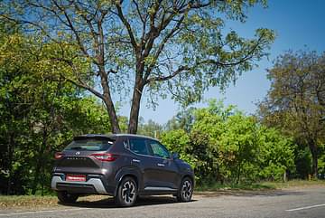
This part of India isn't very scenic and the first 470km till the outskirts of Pathankot were dismissed off with ease without much drama. 95% four lane highway, a toll booth every 30-60 mins and the occasional interceptor, ready to play 'hide and seek' with fast moving cars. We were driving the CVT automatic variant and staying within the legal highway speed limits, the on-board display registered over 18 kmpl as far as economy was concerned.
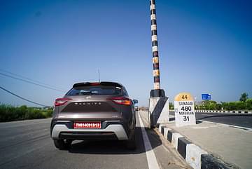
As we neared Pathankot, we got the first view of the mountains and a short stretch of hills. Post that, we entered Jammu & Kashmir and this is where pre-paid SIM cards stop working. With our Covid-19 vaccination reports checked, we proceeded ahead and our eyes kept hunting for mountain roads.
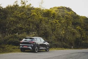
An hour later, we bypassed the winter capital city (Jammu) and got our first proper tryst with hilly terrain. This direct route to Udhampur negates the need to enter Jammu and goes via the Mansar lake. Truck traffic aside, the route is narrow but good and also hinted at what was to come our way the next day.
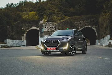
Day 2 : Udhampur to Sonamarg
Distance : 290km
Elevation at night : 9000 ft
Peak elevation en route : 9000 ft
The Jammu - Srinagar highway has improved massively in the past few years. Yes, road work is still on at places but the average pace of covering distance has gone up. We were able to leave Udhampur by 8am and thankfully witnessed only light traffic on the highway. With a wide valley to our right, the Magnite CVT covered group rapidly till we hit the 9.28 kilometre long Patnitop tunnel. Situated at an altitude of 4000 feet, this tunnel helps travellers avoid the slow drive of going up and down the hill-station of Patnitop.
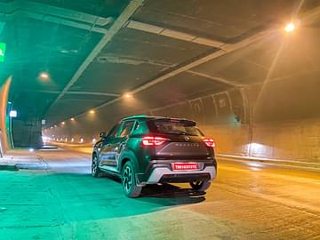
Do note, this image above was taken in designated 'parking' patches that come up every few kilometers. Post this tunnel, it was time to take a quick break for late breakfast. The on-going road work meant the Magnite wore a layer of dust all around but it did end up looking purposeful enough, as if ready for the adventure coming its way in the next few days.
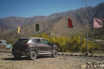
The distance between Patnitop and Banihal tunnels is just 70km. However, the highway being narrow at places and numerous small towns falling en route, traffic jams are common. It took us a good 2.5 hrs to cross this stretch but I wasn't complaining thanks to the fantastic CVT set-up. It gives you access to (literally) unlimited ratios to play with and closing in on gaps becomes a child's play.
We finally hit the four lane approach road 8.45 km long Banihal - Qazigund tunnel and stopped for a quick shot of the Magnite. Looks good in the picture below, eh?
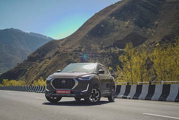
Post the Banihal tunnel, we were greeted with majestic views of the Kashmir valley. This being the last few weeks of winters also meant snow peaks would be a common sight. Plus Spring season brings out the best in terms of flowers and the valley wore a blanket of green and yellow flowers as seen in the picture below.
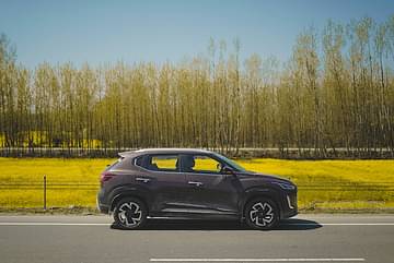
The last 75km to Srinagar was quick, thanks to well laid our 4-lane stretch. By 1pm, we were in the heart of the city, nex to the beautiful Dal Lake. It wasn't easy reaching here due to the season rush of tourists, plus the on-going tulip garden festival. However, once at the lake, it was time for a photo-op and soon we were back on the highway.
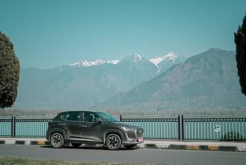
Our destination for the night was Sonamarg, aptly named as it is usually surrounded by white gold from December to March. But before we got there, we had to cover the two hour drive from Srinagar.
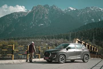
While the route started off with a nicely laid two-lane stretch, we were soon driving on broken tarmac due to the on-going construction of the Zoji la tunnel. And this is where we came across the numerous little glaciers melting into the flowing Sind river - what a sight it was, you will agree!
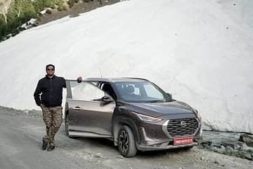
We hit the bed early this evening as the day ahead could be full of surprises!
Day 3 : Sonamarg to Leh
Distance : 340km
Elevation at night : 11,000 ft
Peak elevation en route : 13,550 ft
Thanks to the efforts of BRO (Border Roads Organization), the Srinagar - Leh highway was opened up in record time. The tough to conquer Zoji la pass was made motorable in March itself and this also meant snow walls and slush on the way. The road had been thrown open to civilians just two days back and understandably a huge rush was to be witnessed on the way.
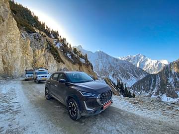
This was the reason we hit the road before 7am. The initial 10km were easy and fast. A proper road, great views and increasing elevation. However soon, we found ourselves in the middle of a huge traffic jam. With narrow roads ahead and elements like snow, slush, black ice and little streams, adventure was in store for the Magnite. The multiple jams also saw locals admiring and staring at our four-wheeled companion, it being the only 'compact' car around at that time.
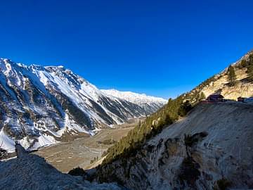
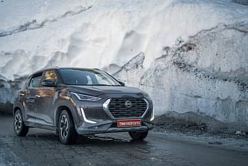
As we continued further ahead, elevation rose and the climb started become tougher. However, the CVT continued to perform well and the 'S' or Sport mode was used often. The oodles of torque from the turbocharged petrol motor also came handy and when the need to overtake slower moving traffic came, the Magnite's 'little wonder' made progress easy. Snow walls, some as high as 20 feet did call for a stop!
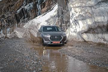
The road to Zoji la had its own share of slush ponds and these turned out to be great photo opportunities with the Magnite.
Soon we were at the top of the Zoji la pass with nothing but snow around. We clicked a few pictures, admired the Magnite and carried further, just to be greeted with endless views of the snow for the next half an hour.
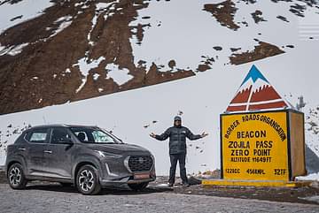
From here on, the run to Leh was effortless and quick. The 280km journey involved crossing Dras, Kargil and two mountain passes on the road. The first one being the 12139 ft high Namika la and second being the 13478 ft high Fotu la.
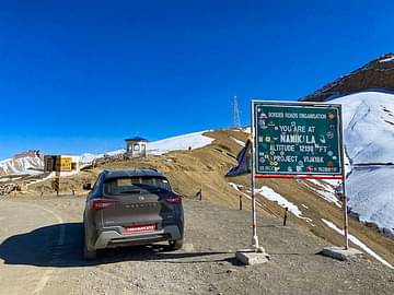
Both the passes usually seen high velocity winds and today was no different. The landscape remains spectacular, including at the town of Lamayuru which is famous for moonscape views.
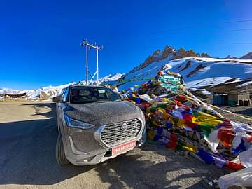
The last 50km to Leh are even quicker, thanks to long & flat stretches. This is where you can enjoy, or rather push your vehicle in terms of performance. Yes, at such altitude, power output does take a hit (less oxygen) but this would be a common issue for us for a few days. By late evening we were in the heart of Leh, ready for the innings the next day.
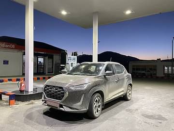
Day 4: Leh to Hanle
Distance : 260km
Elevation at night : 14,600 ft
Peak elevation en route : 14,600 ft
Even three days of non-stop driving to Ladakh didn't slow us down. The Magnite's comfortable driving dynamics ensured that we carried on ahead, this time to the lesser explored parts of Eastern Ladakh. However before we left Leh, a much deserved bath was in store for the Nissan Magnite.
Hanle is known for the world's second highest observatory and as the bird flies, is about 25km from the Indo-China border. The first 70 odd kilometres to Hanle are quick and easy. The road is wide and straight, snow peaks give you constant company and elevation change isn't much.
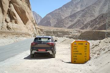
The slight dips and undulations on the road didn't bother us much and even keeping close to triple digit speeds was easy. At Karu, we crossed the left junction that goes to Pangong lake and a while later, we kept straight at the Upshi turn off that leads to Manali. Traffic from here on would come down drastically.
Soon straight roads gave way to winding ones and though the speeds did drop, superb tarmac kept us going fast. The Magnite is a light compact SUV and flicking it around bends and corners is fun. The tyres don't give up too early and the torque flow once the turbo spools up is addictive.
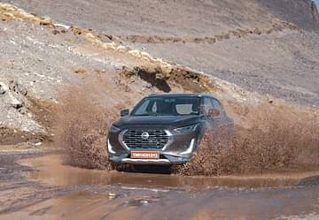
We took a break at Chumathang and this is where road work was in progress. For over half an hour, the Magnite negotiated broken tarmac, slush and a very dusty environment. And then we entered the a vast valley that seemed to extend into the never ending horizon. We hardly came across a vehicle or two every half hour and the network icon on our mobiles refused to show any signal. Perfect escape for us!
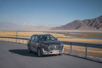
Twenty minutes after Nyoma, we came across another junction. Straight would take us to Hanle and the Army Jawan at the check post was rather surprised to see a 'tourist' vehicle come up at this time of the year. It took a few minutes to get our permits checked and from here on, the last 50km run to Hanle was completely isolated.
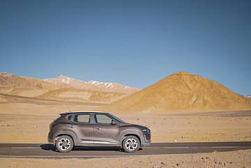
Strong winds picked up find sand from the valley side, the peaks ahead kept opening up at we neared our destination and the capable Magnite carried ahead with total confidence.
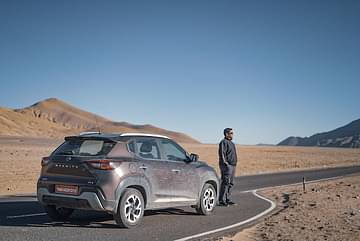
We did stop for a few shots, some of which you see here - very important to soak in the views and relive the moments later on in life. We drove into the little village of Hanle by 5pm and prepared ourselves for the most epic drive of our lives coming up the next day.
Day 6: This was it!
We woke up early. Why? The night before had been restless and devoid of sleep. This was partly due to the excitement of what lay ahead and majorly due to the altitude sickness. By 7am, we were out of the homestay and on a route that is not marked on any map. The total distance to Umling la via the conventional route involves passing Photi la but our local friend knew a 'short-cut'.
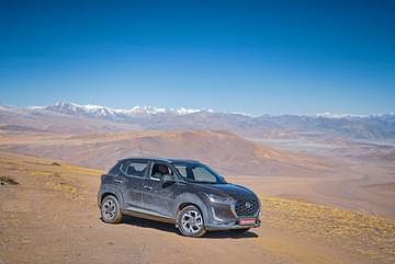
This involved driving through a vast valley with no road but dirt trails that locals use. These trails were more or less straight but had a gradual incline that kept getting higher and higher. With not a sign of human civilisation around but the occasional Himalayan wild ass (known as Kiyang) for company, we drove in this valley for about 30 minutes and then took a serious of uphill bends to get to the top of the mountain. The picture above shows the 'valley' we came from.
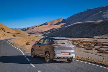
Soon we hit tarmac and this was a big surprise given the remote location. We were now well above 16000 ft and frankly, for us humans, breathing became difficult. But the views kept us going ahead. The shot taken above showcases the dry landscape and dusty rear windshield of the Magnite. Though it was just about 8am, the sun shone hard and this in turn resulted in a 'warm' cabin, thanks to the green house effect.
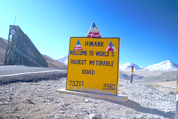
Fifteen minutes later, the view of Welcome to World's Highest Motorable board sent goosebumps across our arms. This was it. This was what we came here for. As the excitement grew, we across a stream that was completely frozen into rock hard ice. A break here was worth it and the picture you see below was taken here.
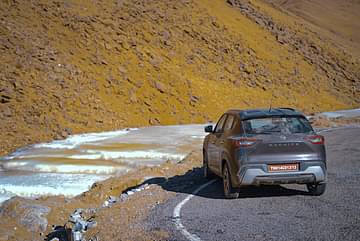
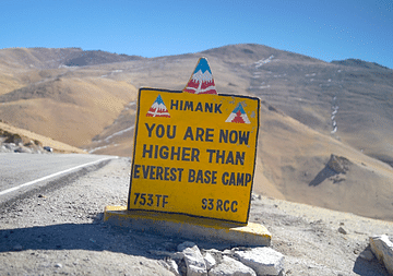
As we carried on further, the climb continued. We were gradually going higher than all the mountains around and though sun was out, the wind outside certainly felt chilly. Vegetation of all types disappeared and then we saw a sign post that kept the adrenaline levels high. Yes, we were higher than the base camp of Mt Everest.
With a grin on our faces we carried ahead and soon had the first view of the mountain pass. Goosebumps ran across our bodies as we drove up and saw the board that was making news lately - Highest Motorable Pass in the World
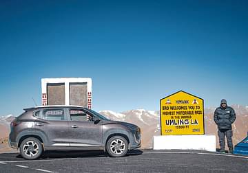
Stepping out wasn't easy. I am not exaggerating but at this height, every single step was an effort. Plus the icy high speed winds that pierced through our exposed skin. But pictures and video shots had to be taken and five minutes later, we sat back inside, thanked the Magnite and started our journey back to Delhi.
Was this the best adventure ever? No. This was beyond that, an epic drive that will remain in my memory lane forever!


